
Daniel Katz - daniel@aerotas.com
This is the first in a series of blog posts supporting our article in the Summer 2016 issue of California Surveyor magazine — you can download the magazine here, and find our article on page 37.
In our article, “What you need to know to determine if UAVs are right for your survey business,” we identify the key factors that land surveyors must consider when deciding whether to begin using survey drones as part of their business. In the magazine, we kept the discussion high-level, to make the contents accessible to the largest number of readers. However, each topic we addressed warrants greater depth.
In this post, we will dig in to the first topic that a surveyor needs to understand before deciding whether to start using a drone for aerial mapping: the basic stack of survey drone technology. As we discussed in the Cal Surveyor article, the basic mapping drone technology stack consists of mission planning and drone autopilot software, the UAV and payload, and image processing software. Running a successful mapping drone operation requires understanding and selecting the right tool for the job within each of these technological components.
The Survey UAV Mission Planning & Autopilot Software
Ensuring that a drone mapping job is successful starts well before the actual aerial survey, with mission planning. When we set up a client with “mission planning” software, we are actually aggregating several separate pieces of software, and tying them together with defined operational procedures. Taken together, mission planning software answers the questions: where, when, and how. Good mission planning software ensures that the location of the UAV aerial mapping job will not conflict with any FAA air space restrictions; that the job will take place at an optimal time considering business operations, weather, and other factors; and that the equipment and operational procedures are prepared optimally — such as having the batteries and autopilot flight settings.
While the right mission planning software ensures the mission is prepared for correctly, the right drone autopilot software will ensure the mission is completed successfully. Mapping drone autopilot software will effectively manage the entire aerial mapping operation. The drone surveyor need only to set the area to be mapped, set altitude and image overlap (which are defined through mission planning), and press the take-off button. The right UAV autopilot software will do the rest, flying the drone and capturing images. While choosing an autopilot software may seem straightforward, there are actual several factors that will affect the drone survey data quality, for example whether the software triggers the camera through the controller or through the drone itself, or whether it takes photos while the drone is turning or only while flying straight. Aerotas has studied these factors in order to identify the most accurate mapping drone autopilot.
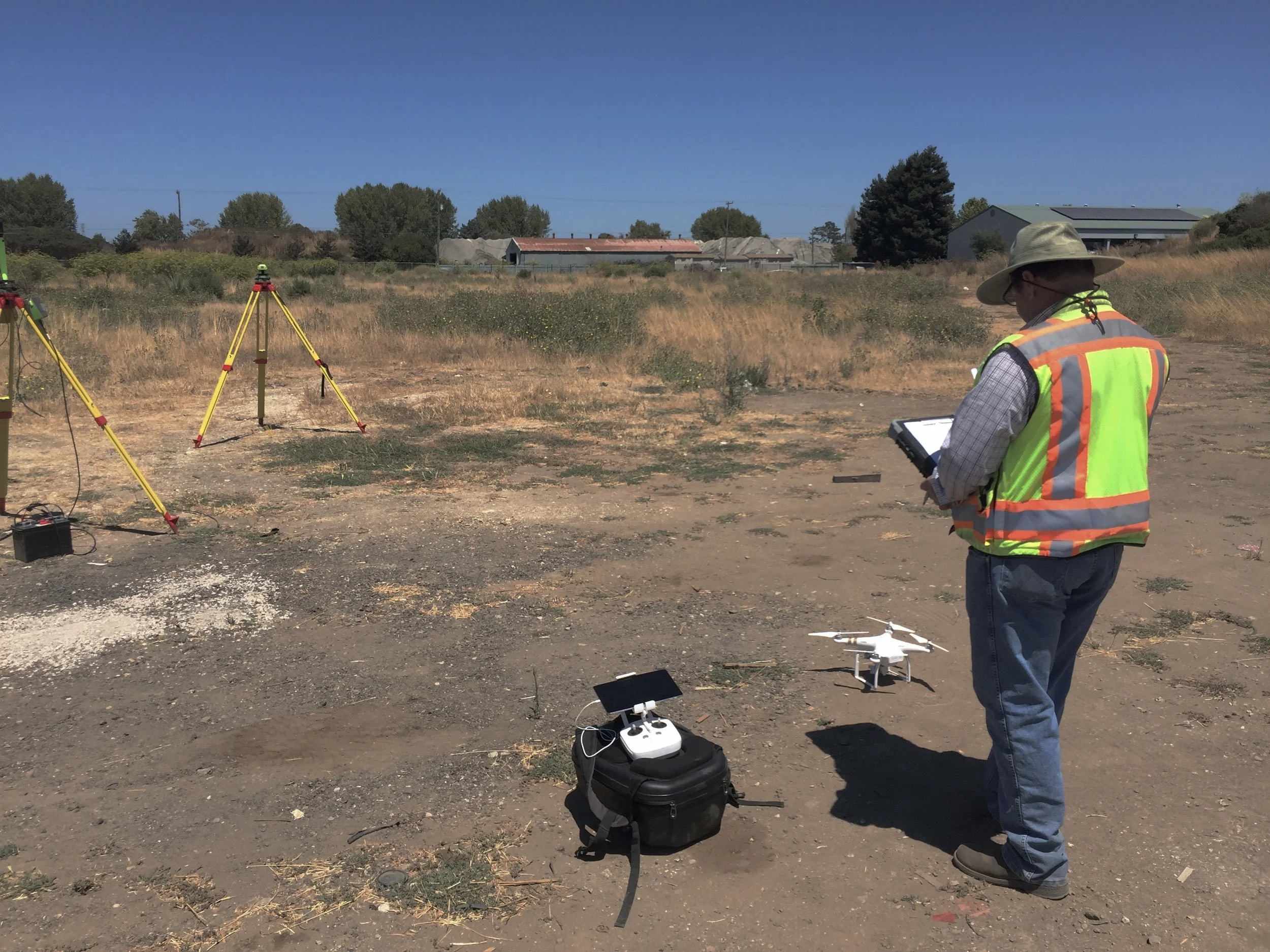
The Mapping UAV and Payload
As surveyors consider investing in drone technology, our strong advice is to take a minimum viable approach, and then scale up once the investment is proven out and the team becomes proficient. This means starting with survey drone technology that is capable, proven, and inexpensive, rather than opting for highly-specialized or cutting edge.
The first decision most new would-be UAV surveyors face is which type of drone to us: multi-rotor or fixed-wing. The key benefit of a fixed-wing drone is range: they can fly for longer, thus completing aerial mapping jobs over larger parcels of land. Unfortunately, FAA drone regulation effectively renders this benefit moot, because it requires that a drone operator maintain their drone within line of sight at all times. In our experience of real-world drone survey operations, line of sight can be maintained on a job up to about 70 acres. Most good multi-rotor drones can cover that much area, meaning that the benefit of fixed-wings is less meaningful. Considering that fixed wing drones tend to be more expensive than multi-rotors, and are generally more difficult to operate, we rarely recommend that drone surveyors use fixed-wings.
Much of the excitement about survey drones arises from the idea of the variety of sensors they can carry. While there certainly will be many opportunities as sensor technologies are developed, we advise our survey clients to start with standard RGB camera payloads. Lidar in particular will present substantial value; however, in our analysis, it is worth waiting for the technology to mature since it is currently very expensive and only presents marginal benefits over standard cameras. When considering a camera, it is important to consider not just sensor size (megapixels), but lens quality, and shutter style as well.
The Survey UAV Data Processing Software
Turning raw aerial photos into a valuable deliverable requires specialized image-processing software. There are several options for drone mapping software, but all operate on the same basic principals of photogrammetry. The software stitches the individual images together to create both an orthophoto and a 3D digital model, which are geo-referenced using the GPS data collected by the drone and/or additional ground control points.
The multiple data processing software programs differ on a number of factors, from capabilities to ease of use to cost. In our experience with our drone surveyor clients, in order to prove value wth a drone, the key factor to optimize for is data quality and thus map accuracy. This often means using a software program that is more expensive and involves a steeper learning curve. Learning this software simultaneously with becoming proficient with the basic operation of the survey drone is a steep requirement for many firms. In order to become proficient with the drone photogrammetry software, it is essential to be using it regularly. For this reason, when we start survey clients with our Aerotas Map Package, we provide data processing as a service to them, which allows them to focus on becoming proficient with the drone mapping operation. Once they are comfortable with the drone operation, then we help the learn and become proficient with the drone photogrammetry software.
Choose the right tools for the job
No matter the operation, a key to success with a new drone operation is choosing the right tools for the job. This is the primary goal behind the Aerotas Map Package — our complete turn-key solution for surveyors who want to start mapping by drone. We have curated a best-in-class package that removes the guesswork for surveyors who are ready to start owning and operating their own mapping drone. Learn more about the Aerotas Map Package here, or contact us with questions at info@aerotas.com.
Daniel is Cofounder and Head of Strategy of Aerotas. He has a rich background in strategy and innovation consulting, helping businesses from startups to the Fortune 500 identify opportunities for innovation. Daniel is passionate about helping organizations see and incorporate new ideas into their business operations.