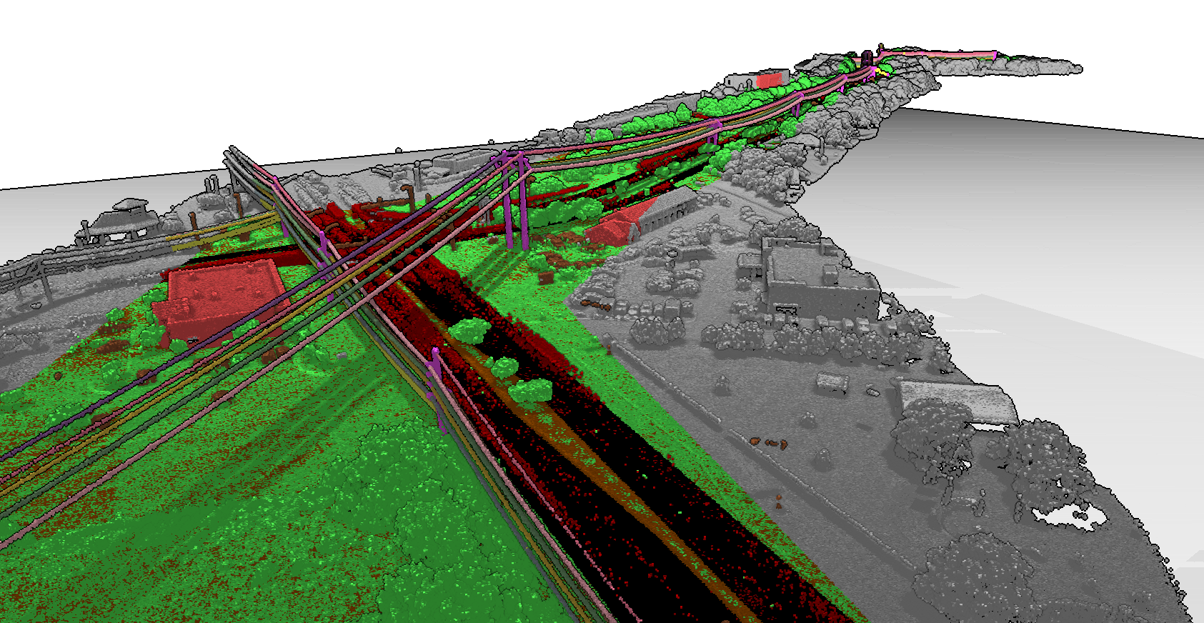
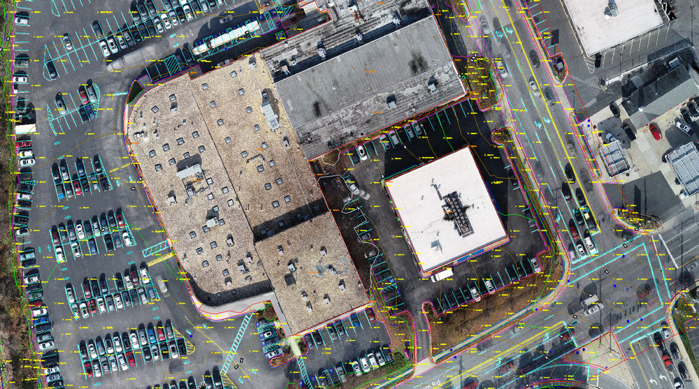
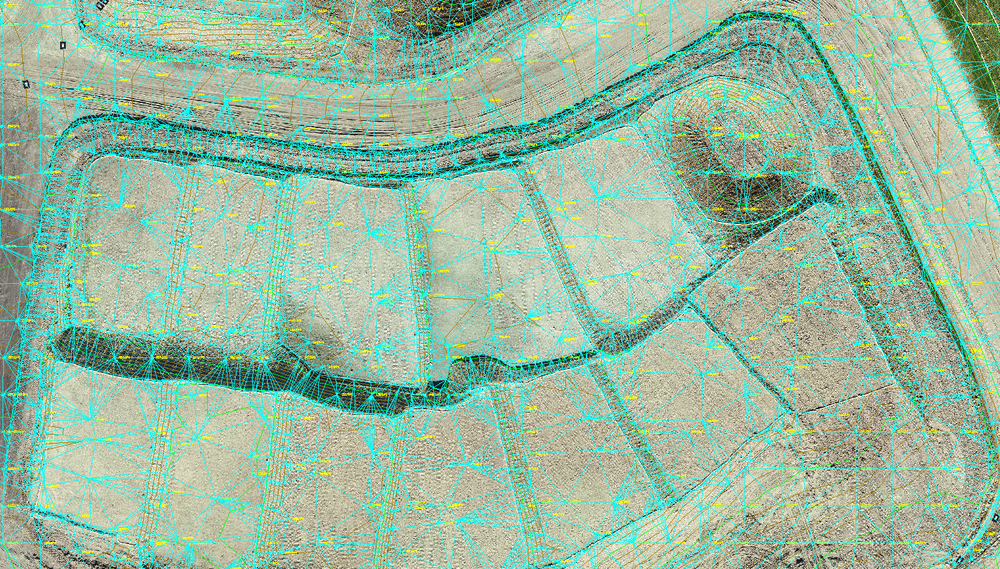
AEROTAS LINEWORK

PROFESSIONALLY DRAFTED FROM YOUR DRONE DATA AND DELIVERED IN CAD FORMAT

  • 0.1’ vertical accuracy or better on most projects

  • 90% time savings (compared to traditional surveying)

  • Industry leading quality

  • Professionally drafted in the USA

  • Lightweight, easy to manage files

  • All the data you need, none you don’t


Aerotas Data Processing Products

Choose the right deliverables for your project

Full Linework

Photogrammetry + Clean Topo Surface / TIN + Planimetrics

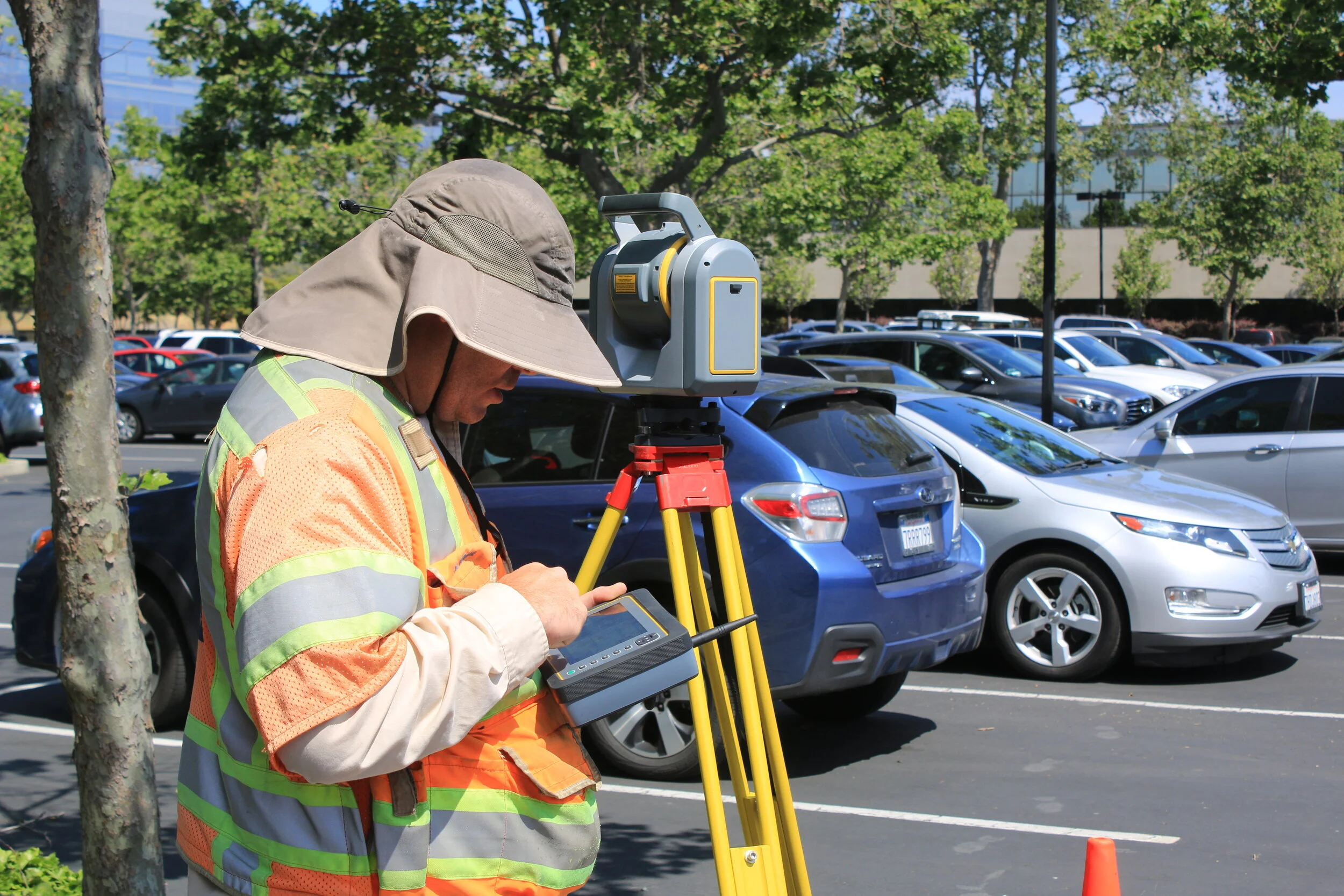
Full linework includes all planimetric features that are visible from the air, plus clean topographic data with spot elevation points, breaklines, 1’ contours, and a TIN surface. Aerotas will mark all visible features such as paint striping, utility access panels, edge of pavement, building driplines, and more. These files are delivered as a single DWG package containing all of the above-mentioned deliverables. Drafted linework includes all Photogrammetry deliverables.

Specs / What’s Included | File Formats | CAD Layers

Available Add-Ons: Building Footprints | Roof Features | Utility Marking Paint | Pipe Cluster Driplines | Light Fixtures | Power Pole Tops | Power Line Attachment Points | Transformers | Golf Course Features | Stockpile Volumes | Surface Comparison | Rock Outcroppings | Individual Tree Driplines | Road Cross-Sections | Custom

By creating a free account, you can download demo files and request free quotes.

Clean Topo Surface / TIN

Photogrammetry + Clean Topo Surface / TIN

Topo only linework includes clean topographic data with spot elevation points, breaklines, 1’ contours, and a TIN surface. Because they are manually drafted, the contour lines are cleaned so that miscellaneous objects, such as cars, equipment, buildings, or vegetation, are not included. Topo only includes all Photogrammetry deliverables.

Specs / What’s Included | File Formats | CAD Layers

Available Add-Ons: Stockpile Volumes | Surface Comparison | Rock Outcroppings | Individual Tree Driplines | Road Cross-Sections | Custom

By creating a free account, you can download demo files and request free quotes.

ALTA/NSPS Standards

Photogrammetry + ALTA/NSPS Land Title Survey Requirements

ALTA standards dictate a very specific set of requirements. This product option aligns perfectly with the requirements for ALTA/NSPS land title surveys and allows surveyors to add “Table A” options when necessary. While the drone cannot check all the boxes for an ALTA survey, we can get you closer with improved CAD layers, along with additional modifications and improvements to our drafting and marking methodology. This product provides all of the information that a drone can collect in compliance with the ALTA/NSPS Standards.

Product Description | CAD Layers

Available Add-Ons: Topo Surface and Contours | Exterior dimensions of buildings | Square footage of building footprints | Measured height of buildings | Number and type of parking spaces | Custom

By creating a free account, you can download demo files and request free quotes.

Photogrammetry

Photogrammetry Only

Photogrammetry only is for when all you need is accurate imagery to back your existing projects and drawing, or when you want to draft on the imagery yourself. It does not include a surface and clean topo. It does not include any professionally drafted features.

Specs / What’s Included | File Formats | File Descriptions

By creating a free account, you can download demo files and request free quotes.

1. Request A Quote

Sign In or Sign Up at aerotas.com/app and start a new project by requesting a quote. Quotes are free. No credit card needed.

Upload a Google Earth File (KML/KMZ) with a polygon outlining your area of interest, select the deliverables that you want, and we will send you a firm quote same day. No risk. No obligation.

2. Accept the quote

Sign In at aerotas.com/app, review your options, and select the quote that’s right for your project.


3. UPLOAD YOUR DATA

Sign In at aerotas.com/app and upload data using our simple drag and drop uploader. Send us your photos, ground control, and any other data you have. Our photogrammetrists and CAD technicians will start work right away.


Questions? Contact us anytime at (949) 335-4323, or info@aerotas.com.
Or, visit our resources page for more details about how Aerotas Linework works.

Flexible pay-as-you-go

Try it out! Get a free quote.

Aerotas pricing is quote-based for each individual project.

Quotes are free. No credit card needed. It’s as easy as it sounds.

Aerotas creates quotes for each project based on that individual project’s size, complexity, and the deliverables requested. Our pricing is extremely competitive, offering up to 90% cost savings over traditional surveying methods.

Aerotas provides human-in-the-loop drone data processing for surveyors. Aerotas is a technology-enabled services company that delivers survey-grade CAD files created from drone-collected data in days, not weeks. Data is handled by ASPRS Certified Photogrammetrists and CAD Technicians in California who correct errors and perform quality assurance checks at each step in the data processing workflow. Drone photogrammetry and CAD drafting services are enabled by a combination of advanced technology, high-performance computing architecture, and human expertise — providing fast and predictable turnaround times, lower drone survey costs, and the most accurate deliverables anywhere (0.1’ vertical) to 1,500+ leading survey and civil engineering firms across the United States.

Aerotas has been great for us. You could learn all of the information on your own, buy the software, and gear to get up and running; we had tried this for a year or so. Aerotas had all of the pieces figured out, trained us in a day and we were up and running and making money the next day.
— Robert Watt, NMPS # 11770, CFEDS, Red Tail Surveying
Expert+survey+drone.jpg
The entire service Aerotas provides is more than expected. I realize that I have done more than purchased a tool. I have partnered with a team that has enabled my business to do more. A lot more.
— Michael T Reynolds, Oklahoma PLS #1651
Michael Reynolds.jpg
 

Land surveying is a critical profession for dozens of industries. Aerotas is committed to protecting land surveyors in every state and territory in the United States and across the world. Our goal is to empower surveyors and engineers to do their work accurately, effectively, and reliably. Because of that, Aerotas will only work with licensed surveyors or engineers. Interested in learning more about becoming a land surveyor? Visit surveypath.org or check with the association of professional surveyors and state board of licensure in your state to learn what it takes to become a land surveyor. 

Aerotas provides linework services to professional land surveyors and engineers throughout the United States. Please check with your state board for any applicable regulations.