
In an interview with Commercial UAV News, Aerotas founder Logan Campbell helps readers determine which of the many options for processing drone data is best for them. There are so many options for turning photos from a drone into some sort of final product that it can be quite confusing for many businesses.
We often help land surveyors determine which data processing option is going to be best for them. One of the most important factors is understanding the trade offs of purchasing the data processing software themselves, versus having an expert provider like Aerotas do the work for them. The challenge is that processing drone data into ortho-images, 3D surface models, and linework requires a great deal more specialized computers, software, and know-how than often seems to be the case.
In the below excerpt, Logan digs into some of the key trade-offs and unknowns we come across among land surveyors looking to process their drone photos into final survey data. If you are ready to start a complete drone surveying program, or to professionalize your current program, visit aerotas.com/map. To read the complete interview, visit Commercial UAV News.
Commercial UAV News Interview: "How to Determine Which Drone Data Processing Solution Fits Your Business Need"
Jeremiah Karpowicz, Commercial UAV News: When it comes to local, self-processing, how often do you run into users who don’t know what they don’t know? That is to say, someone thinks they know what they’re getting into when taking full control of their drone data processing, but find out the reality doesn’t line up with their expectation.
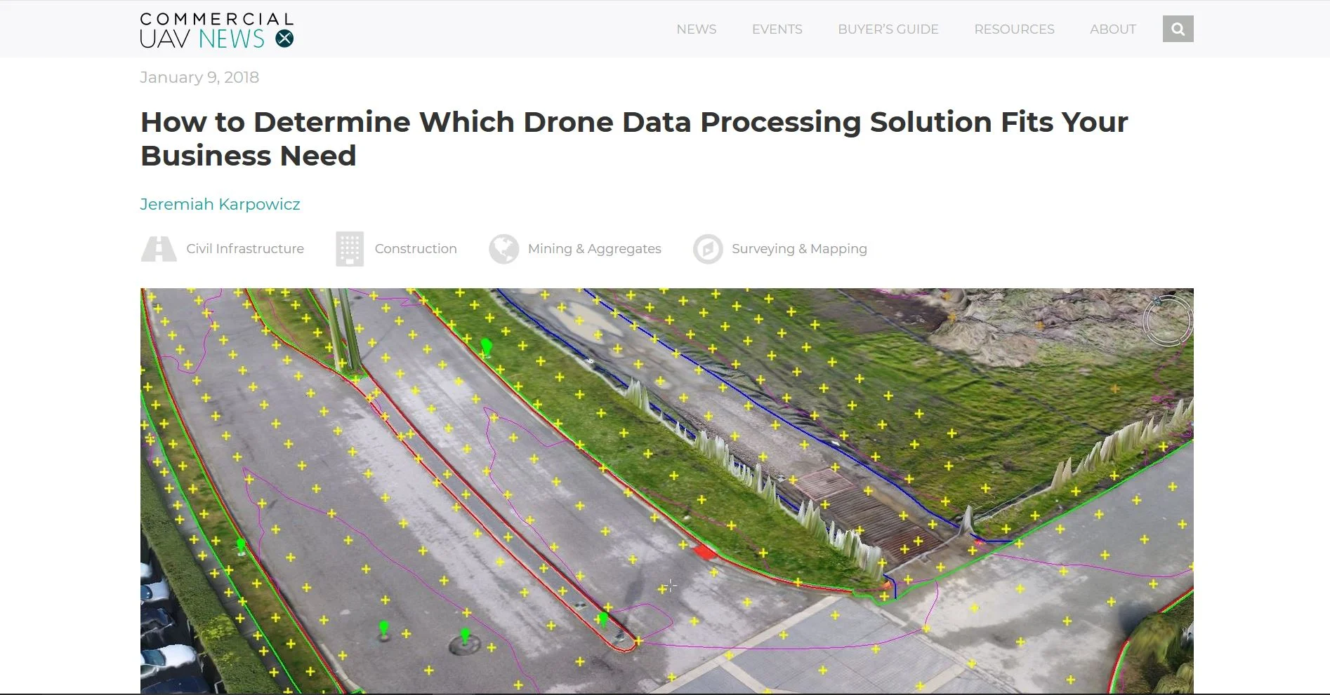
Logan Campbell, Aerotas: This happens all the time. Software has made it so easy to produce a visually striking, beautiful 3D model. Anyone can do that. However, it is difficult to truly understand the difference between a good-looking model and an accurate model.
Most people don’t realize that there is an enormous amount of work and science that goes into verifying the accuracy of drone data. The best way to learn more would be to check out ASPRS Positional Accuracy Standards. I personally am certified by the ASPRS as a Certified Mapping Scientist in UAS, which demonstrates the dedication we have towards high quality processing.
JK: What kind of bottlenecks can be created with self-processing? What kind of impact can this have on the bottom line for a project?
LC: Processing drone data requires really powerful, specialized computers. And even with this specialized hardware, the data processing will eat up 100% of that computer’s processing capability for hours at the minimum, and days for bigger projects. We have seen often people who think they can process drone data in the background of their computer, only to realize that there simply isn’t enough processing power for everything they want to do, either delaying critical CAD work, or the drone data processing. As usual, this means more time delays, and costs more money.
Also, processing takes a lot of time from skilled employees. It can take hours of working with a project to get the final accuracy numbers right, even with a lot of computing resources. That is time that could be spent on other valuable client deliverables.
JK: What advice would you have for someone who is trying to figure out what process is going to work best for them, but are having trouble making a decision even after weighing out the pros and cons of each approach?
LC: Start with the easiest way to get high accuracy and then see what is right for you. The biggest mistake is spending thousands of dollars on specialized hardware, software, and training only to discover that isn’t the right workflow for you. Cloud based and expert processing is usually billed on a per-month or per-project basis, keeping up front costs down. See if those are right for you, and you can always buy the expensive stuff later.