How drones are helping rebuild after the California wildfires

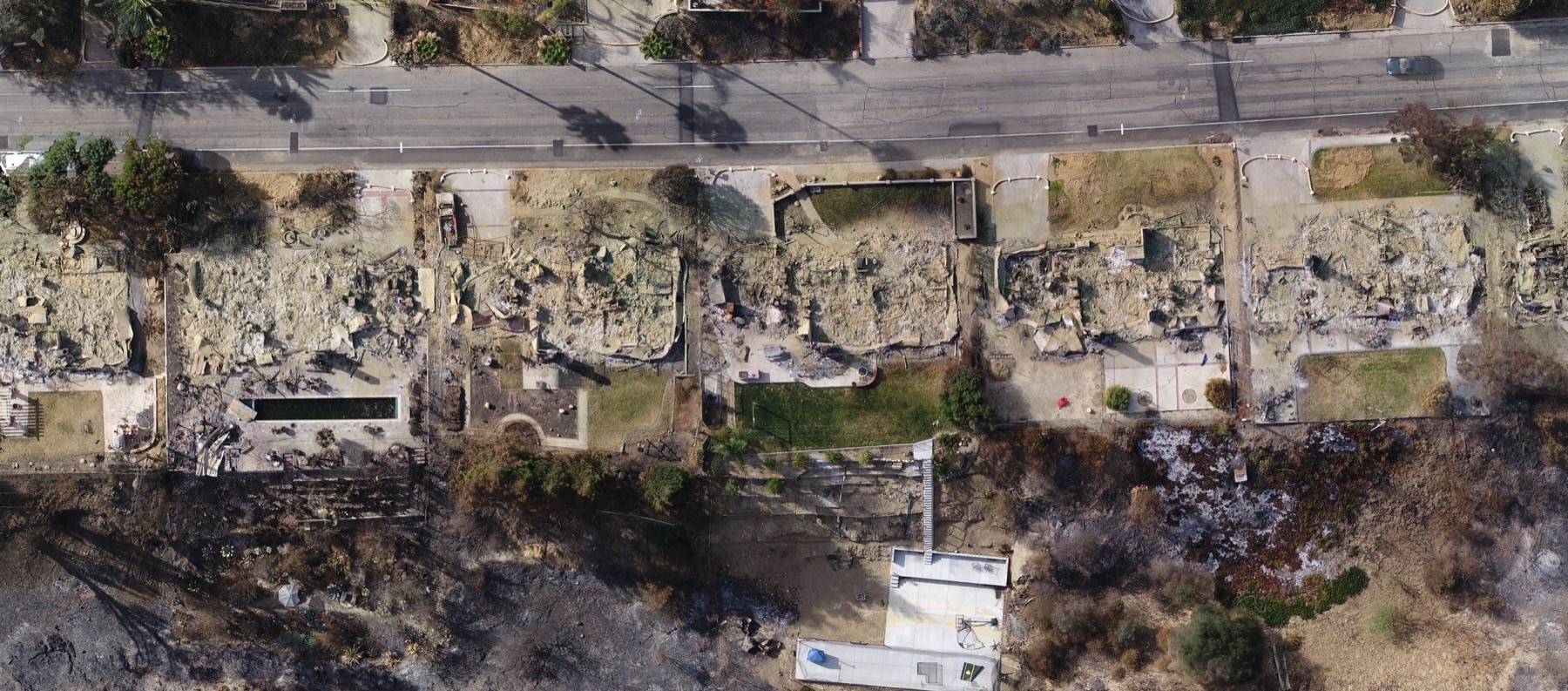
The recent California wildfires destroyed thousands of homes, leaving many people struggling to get back on their feet. And even though the fires have all finally been put out, much of the work remains ahead. Rebuilding after such devastation can take years, adding heartache and financial strain on already troubled families. Thankfully, drone technology is making this process smoother. While a drone can’t pick up a hammer and rebuild a house, a good drone program can make much of the rebuilding process easier on homeowners, land surveyors, and many other parties involved in getting life back to normal. WM Surveys in Ventura, working with the Aerotas Mapping System, is helping to do exactly that.
Drone Surveys Help Homeowners
The homeowners are the ones hit hardest by natural disaster, but drones can also help them out the most. After a fire, a land surveyor needs to come out to accurately map the property for insurance claims and for demolition, cleaning, and rebuilding. After a natural disaster, the wait time for such a survey can easily extend into weeks or even months, and then take hours once on the site. However, using drones lets surveyors cover dozens if not hundreds of houses in a day, dramatically reducing the wait time to start the insurance and rebuilding process. Additionally, because drone surveying is so much more efficient than traditional land surveys, they often are cheaper too. All of this means that a homeowner can rebuild faster, easier, and more affordably than ever before.

Drones Help Land Surveyors
Homeowners aren’t the only ones to benefit from drone based surveys: the land surveyors themselves benefit too. Surveyors are facing a hiring crisis, with too many jobs and not enough manpower, a problem only exacerbated by natural disasters. However drone technology can serve as a force multiplier for field crews. What might take a single field crew 4 hours in the field will only take 30 minutes. In the time a traditional field crew could topo a single lot, a drone could topo an entire block. This means that surveyors can do more jobs, with fewer field crews. And money isn’t even the only benefit to using drones. After disasters, there can be dozens of potential hazards to people working on the site, from asbestos, to hot spots, to broken glass. A drone flies above the damage and debris to keep those on the ground out of harm’s way. Overall, land surveyors can safely do more projects, with fewer workers, while helping residents rebuild.


Drone surveying Helps Everyone rebuild
The benefits of drone surveys go far beyond just the homeowner and the land surveyor. After a natural disaster, even once all of the first responders head home, hundreds of parties get involved in the rebuilding process. Insurance agencies need to process claims, governments need to rebuild infrastructure, municipalities need to approve new building permits, utilities need to be repaired, banks need to underwrite emergency loans, all while fraudsters try to take advantage of the disarray. Having a drone survey done means that there is an accurate, complete, and indisputable record of the condition of a property, helping companies do what they need to do more efficiently, while keeping money out of the hands of people making false claims. Drones make the whole process move more efficiently.
Start drone surveying today

Aerotas is proud to have developed a system that is helping people through such hard times. But it is companies like WM Surveys that is doing the real work, and we are proud to support them. To learn how your team can start drone surveying, visit aerotas.com/map