

Flight Planning Issues
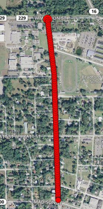
Overlap Too Low
Signs of flight issue:
Not enough photos to cover the area of interests
Photos were skipped on the flight path
GCPs outside of flight area which impacts accuracy
GCPs visible from only two flight lines
Possible recommendations:
Aerotas Resource: Overlap & Flight Pattern
Fly at 75/75 overlap to ensure good accuracy and reliability
Fly at least one flight line beyond required data
Keep the flight area larger than the GCP distribution so each GCP has an adequate level of overlap
GCP needs to be captured in 9-16 photos

Overlap too low
Overlap too low

Overlap too low

Overlap too low
Overlap Too High
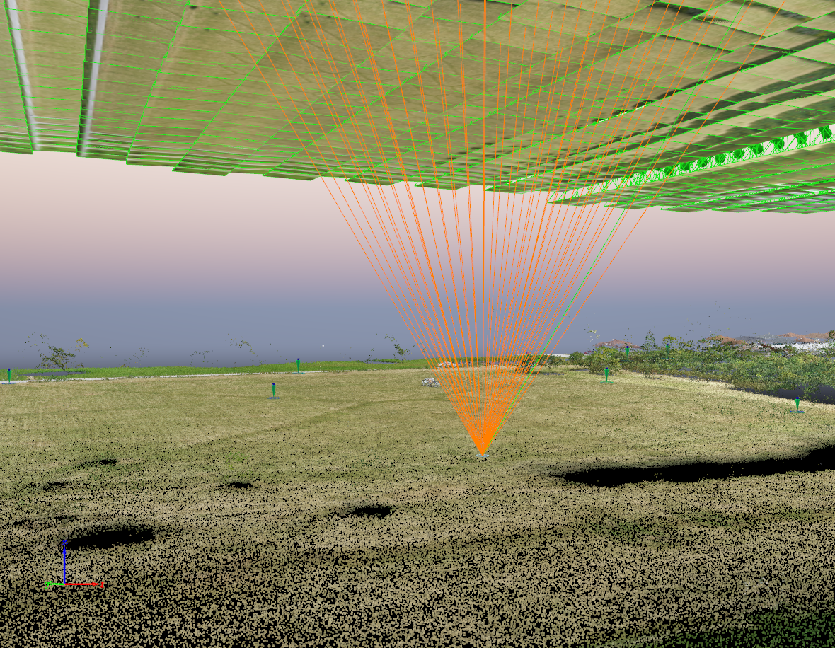
Too many matches. This point is visible in 50 images, should be visible in 16 images.
Signs of flight issue:
GCPs visible in 30+ photos
Troubleshoot:
Remove photos and reprocess
Possible recommendations:
Aerotas Resource: Overlap & Flight Pattern
Fly at 75/75 overlap to ensure good accuracy and reliability
GCP needs to be captured in 9-16 photos
Impact:
Collecting too much data decreases the accuracy of the finished deliverable because of erroneous matches and the introduction of too much noise in the model.

Erroneous Match

Erroneous Match
Unnecessary Cross-Hatch
Signs of flight issue:

Cross-hatch flight pattern
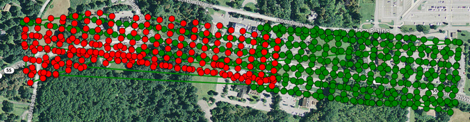
Cross-hatch flight pattern
Possible recommendations:
Fly a single, 75/75 overlap, lawnmower pattern flight which helps reduce field time and speeds up data processing
More data does not mean better accuracy; too much data causes artifacting and noise which decreases accuracy
Aerotas Article: There is such a thing as too much data
Flight Altitude Too Low
Signs of flight issue:
Gaps throughout the site due to low overlap
Possible recommendations:
Aerotas Resource: Choosing Flight Altitude
Fly/Re-fly at a higher altitude
High Relief: Low Overlap at High Elevation
Signs of flight issue:
Low overlap
The flight was flown at constant elevation while the site has elevation changes
Patchy areas
Photos that do not calibrate despite not being water or shrubbery
Possible recommendations:
Aerotas Resource: Choosing Flight Altitude
Use an autopilot with the Terrain Awareness feature, found in Map Pilot or the DJI GS RTK app
If not enough data to create terrain, re-fly with terrain awareness
Terracing missions. Terracing or “stepping down” your missions is one way to deal with elevation change. The idea here is to fly an area with 50-100’ of elevation change at a time as separate missions.
Take off from the highest elevation on the site. This method is useful if you have a grade change of less than 100’ or so and do not have access to Terrain Awareness. Taking off from the highest elevation ensures that you at the very least, do not end up with too LITTLE overlap.
Any more than 100’ of elevation change and this method becomes impractical due to overlap issues becoming more severe.

Low overlap at high elevation

Elevation change + flat flight path
Not flown with RTK enabled
Troubleshoot:
PPK Processing or process traditionally if there are enough GCPs
Possible recommendations:
Aerotas Resource: P4RTK Field Workflow
Use the DJI D-RTK-2 base station
