Surveying by Drone from a Moving Vehicle

Surveying by Drone from a Moving Vehicle

Logan@Aerotas.com

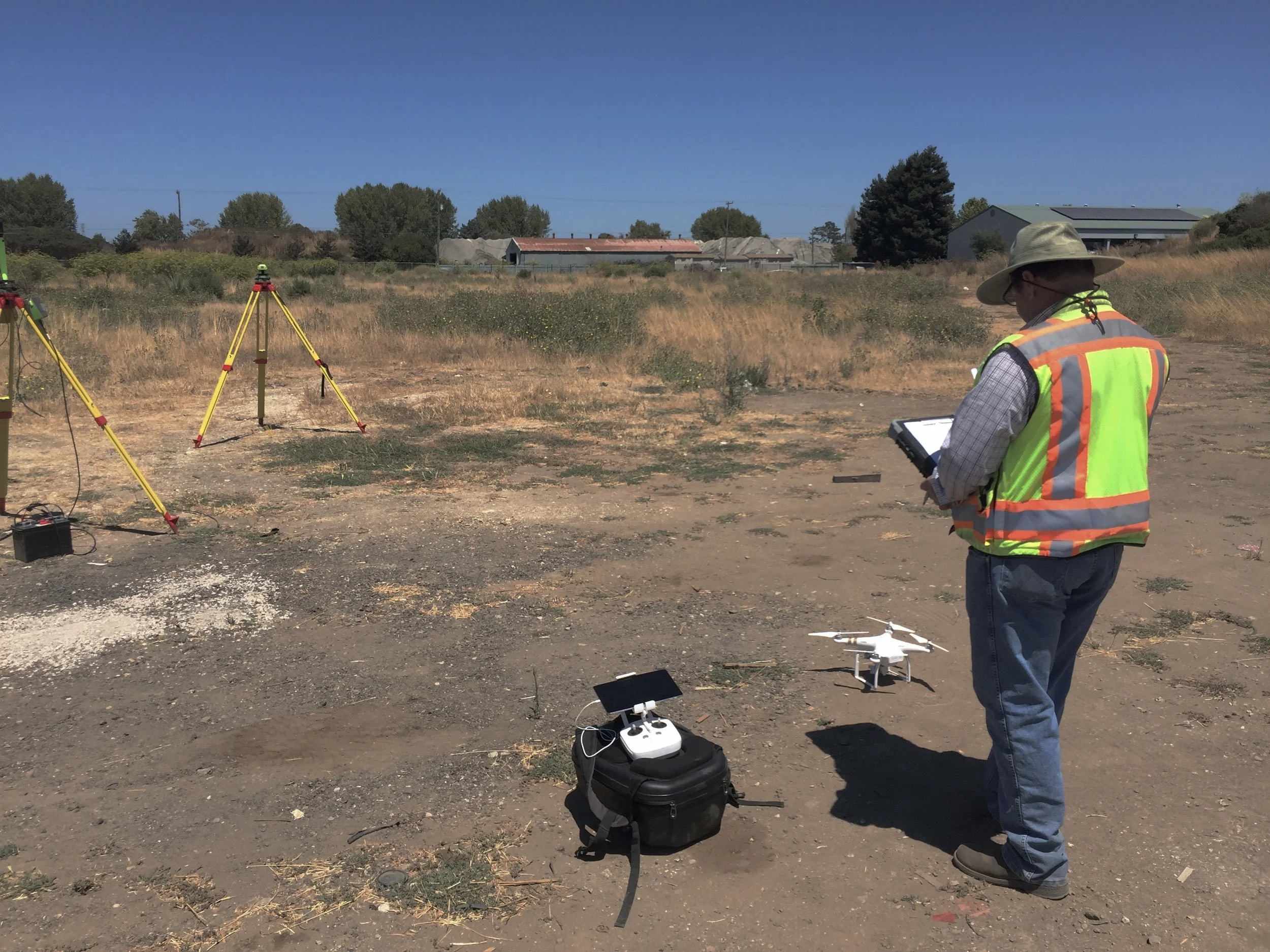
Included in the FAA's new drone laws is the ability to operate a drone from within a moving vehicle. This dramatically expands the areas that drones can cover for mapping or inspection. We took to the deserts of Southern California to see how difficult it is to run a safe UAV operation from a moving vehicle.

What a Surveyor Needs to Know to Start Mapping by Drone: The Deliverables

What a Surveyor Needs to Know to Start Mapping by Drone: The Deliverables

Daniel@aerotas.com

The second in a series of posts expanding on our article in Cal Surveyor. As we discussed in the article, mapping drones can produce three primary deliverables: orthophotos, 3D models, and high-resolution photo and video. In order to use an aerial mapping drone profitably, a surveyor has to understand each of these deliverables and how a surveyor drone can be used to create them. In this post, we dig in to each of these surveyor drone deliverables.

The Key to Success with Drones

The Key to Success with Drones

The Aerotas Map Package is an all-inclusive package of everything an organization needs to start mapping by drone, and it leverages many lessons that the Aerotas team has learned in our consulting practice. It leverages the technology — hardware and software — that we have vetted and found to be most reliable. It leverages our hard-learned best practices in the form of operations guides and training. It leverages thorough study of efficient insurance coverage and regulatory compliance. But the one lesson that it leverages more than any other is this: start simply.

How to Make Drone Operations Reliable

How to Make Drone Operations Reliable

Logan@Aerotas.com

Last week, I spent a day in the field getting a client trained on their new UAV equipment. Naturally, I thought this would be a great chance to test out a new aircraft that we recently received. Unfortunately, I made a mistake that is all too common in UAV operations: I left all of my batteries sitting in their charger back in the office. Having good operational procedures and good training is the solution to prevent this and worse mistakes. In this post we dig into why following procedures and checklists is crucial on every job.

What a Surveyor Needs to Know to Start Mapping by Drone: The Technology

What a Surveyor Needs to Know to Start Mapping by Drone: The Technology

Daniel@aerotas.com

In our article in California Surveyor Magazine, “What you need to know to determine if UAVs are right for your survey business,” we identify the key factors that land surveyors must consider when deciding whether to begin using survey drones as part of their business. In this post, we will dig in to the first topic that a surveyor needs to understand before deciding whether to start using a drone for aerial mapping: the basic stack of survey drone technology.

What Do New Commercial Drone Laws Mean for Surveyors?

What Do New Commercial Drone Laws Mean for Surveyors?

Daniel@aerotas.com

When Part 107 goes into effect in August, it will open huge opportunities for businesses across industries to use drones in daily operations. Given the contents of Part 107 and the state of UAV technology, land surveying stand to benefit more than most industries. In this post we highlight some of the key provisions of Part 107 that will impact land surveyors.

Receiving Waivers Under New Commercial Drone Rules

Receiving Waivers Under New Commercial Drone Rules

Logan@aerotas.com

The FAA recently released its new drone regulations, known as Part 107. Included is a provision that allows the FAA to grant waivers from most of the new restrictions. This waiver process opens up the possibility of dozens of new applications by potentially allowing flying over people, flying long distances, and many other capabilities. Though the potential is significant, there remain too many uncertainties about the waiver process for businesses to rely on it in the near future.

New FAA Commercial Drone Rules Announced

New FAA Commercial Drone Rules Announced

This morning the FAA published the first official set of rules governing commercial drone use: Part 107. When these new rules go into effect in August, businesses and public agencies will be able to use drones in most industrial applications fairly easily. While operators will be required to follow a number of rules, the key requirements decision-makers need to understand are around pilot certification, where to fly, and flying over people.

Drone Day at the Capitol: What We Learned

Drone Day at the Capitol: What We Learned

Daniel@Aerotas.com

On June 14, Aerotas cofounders Daniel Katz and Logan Campbell participated in the Drone Information Day at the State Capitol. The goal of the day was to highlight to lawmakers the ways that drones are positively impacting California and their constituents, offering a counter-narrative to the negativity that tends to dominate headlines. The day presented a unique mix of private meetings and public interaction, via a public display and demo area on the lawn of the Capitol building. The meetings offered a unique view into how the drone industry is considering its relationship to regulation.