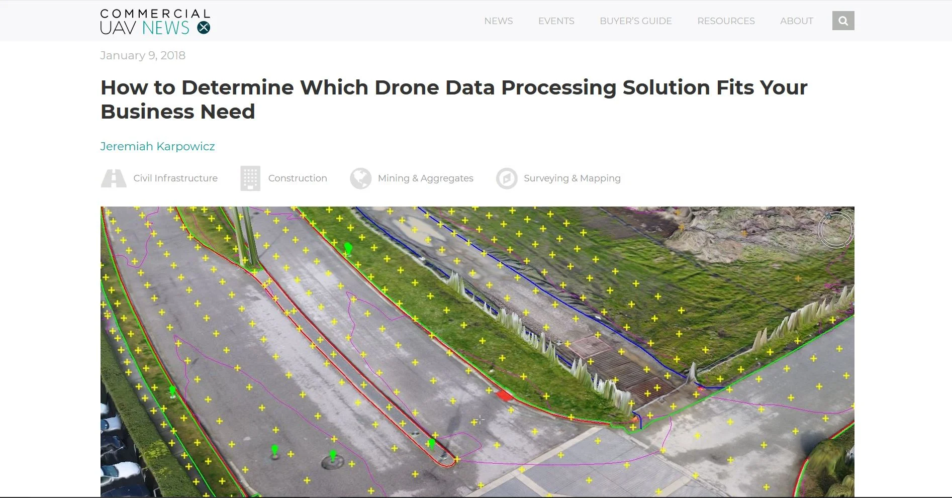
In an interview with Commercial UAV News, Aerotas founder Logan Campbell helps readers determine which of the many options for processing drone data is best for them. There are so many options for turning photos from a drone into some sort of final product that it can be quite confusing for many businesses. One of the most important factors is understanding the trade offs of purchasing the data processing software themselves, versus having an expert provider like Aerotas do the work for them
Drone Surveying Webinar for NYSAPLS
POB Column: Grow Your Surveying Business Without Hiring
Now is the time for a drone investment
The hype is finally dying down in the world of drones. Thank goodness. Throughout 2015 and 2016, many people dreamed and opined about how drones could bring us new shoes in 20 minutes. However we at Aerotas, and our clients, have been focusing on how to actually make drones work in the real world. And now there are 60,000 commercial pilots in the US doing real work with drones – and many of them are surveyors.
Who should process your UAV mapping data?
With the popularity of of UAVs in commercial applications increasing, more and more companies are regularly coming across the question of what is the best way to process drone data. There are lots of different options out there, and this article will describe the three major categories of how to process data, and the pros and cons of each one. Overall, there is no universal best answer. The best way to process data depends on the needs of each individual company.
Can Surveyors Do More with Less by Using Drones?
In a recent interview with Commercial UAV News, Aerotas Co-Founder Daniel Katz discusses the crucial stakes for the Aerotas Mapping System -- and the drone industry writ large -- to solve a critical challenge in the land survey industry.