![[Webinar] The State of Drone Surveying: A Strategic Briefing for 2026](https://images.squarespace-cdn.com/content/v1/54579091e4b05fc750f0d8ea/a6b75fdd-f33d-4130-a4e4-8af16b084092/ChatGPT+Image+Sep+15%2C+2025%2C+11_25_38+AM.png)


Aerotas has been successfully processing data collected with the Phantom 4 RTK since October of 2018. When working with Aerotas, this is the recommended workflow for PPK processing.

In one hour, we’ll show you exactly what changed in 2025 that will impact your revenue, liability, and competitiveness in 2026, and what top firms are already doing about it.
On November 4th, 2025, DJI announced the latest upgrade in their aerial lidar sensors, the Zenmuse L3. But will it be a good sensor for surveyors? And should US surveyors even consider investing in a DJI product given all of the regulatory uncertainties in the world right now? Let’s dive into the details to find out.
Here is the uncomfortable truth: no true peer competitor exists today. Dollar for dollar, DJI remains the best overall platform for most commercial applications. There is no close second. This post explains why, how to think about the current regulatory environment, and what that means for surveyors, civil engineers, or really anyone who cares about safety, turnaround time, and profit.
Airborne RTK for land surveyors has been a technology with an enormous amount of promise for quite a few years now, but was being held back by extremely expensive, complicated, and unreliable technology. However, with the recent announcement of the DJI Phantom 4 RTK, it seems as if this is about to change. Overall, the Phantom 4 RTK is a great piece of technology that will improve both accuracy and efficiency for most surveyors, but it is not a magic bullet. Good operations are required both in the field and in post-processing the data.
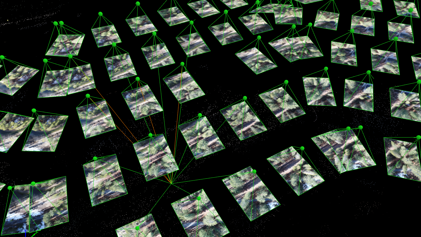
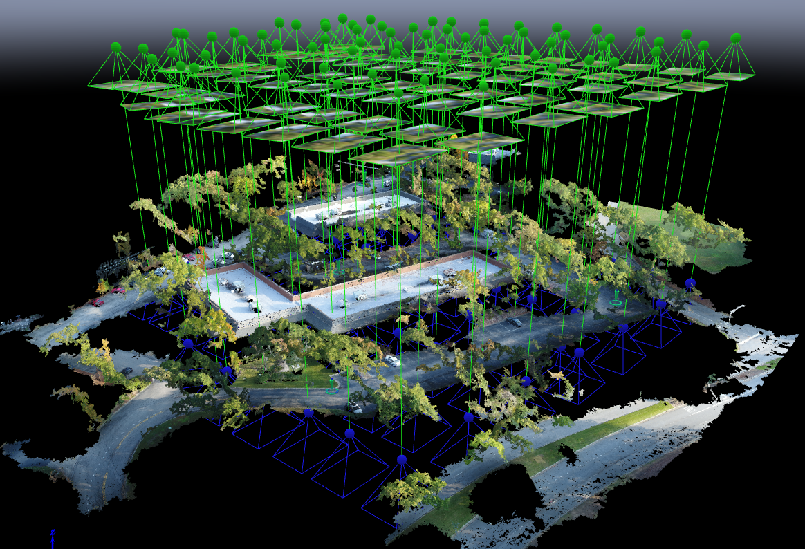
When the American Society of Photogrammetry and Remote Sensing (ASPRS) launched their Certified Mapping Scientist-UAS certification, Aerotas Founder Logan Campbell was among the first people to sit for the test. The intensive experience of studying, preparing, and taking the strenuous exam highlighted how challenging a verifiable understanding of photogrammetry is. However, the real-world experiences that Logan and the Aerotas team have with processing drone data for surveyors reveal the importance of this understanding in the real world.
With Aerotas' position as the preeminent provider of drone solutions for land surveyors, we constantly field questions from surveyors about various components of drone technology. This is the third in a three-part series of articles in Point of Beginning magazine, summarizing our current analysis on key components of drone survey technology. This article focuses on the georeferencing options we most commonly get questions about -- particularly high-accuracy RTK, PPK, or Direct Georeferencing systems.
With Aerotas' position as the preeminent provider of drone solutions for land surveyors, we constantly field questions from surveyors about various components of drone technology. This is the second in a 3-part series of articles in Point of Beginning magazine, summarizing our current analysis on key components of drone survey technology. This article focuses on the sensor options we most commonly get questions about -- particularly LiDAR.
Last week, the California Land Surveyors Association invited Aerotas co-founder Daniel Katz to present a webinar to their members on best practices in drone surveying. With the experience from training and equipping several hundred surveyors nationwide to get best-in-class accuracy and ROI from drone technology, and completing thousands of drone photogrammetry and linework drafting projects, the Aerotas team has learned a great deal about what it takes to benefit from drone technology.
Point of Beginning magazine asked Aerotas co-founders Daniel Katz and Logan Campbell to analyze the various components of drone technology that go into an effective drone survey program. They evaluated three key technologies across three articles: drone airframes, sensors, and georeferencing options. In each article they take an independent and analytical approach to evaluate which drone technology option is best for land surveyors. The first article focuses on drone airframes.