

Use Aerotas Mission Planning
Get it right the first time
Your drone data deliverables are only as good as the data you collect. At Aerotas, we want to make sure you’re collecting the highest quality data possible, the first time you fly a site. That’s where Aerotas Flight Ops comes in. Long gone are the days of uploading and hoping everything comes out alright. When you take advantage of Aerotas Flight Ops, you get peace of mind and confidence that your mission plan is set up for success.


How it Works
What we need from you:
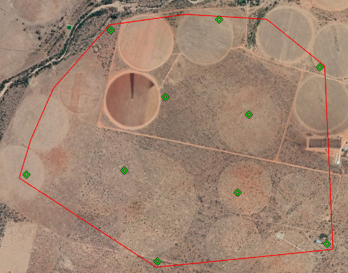
Create a KMZ of your project area in Google Earth
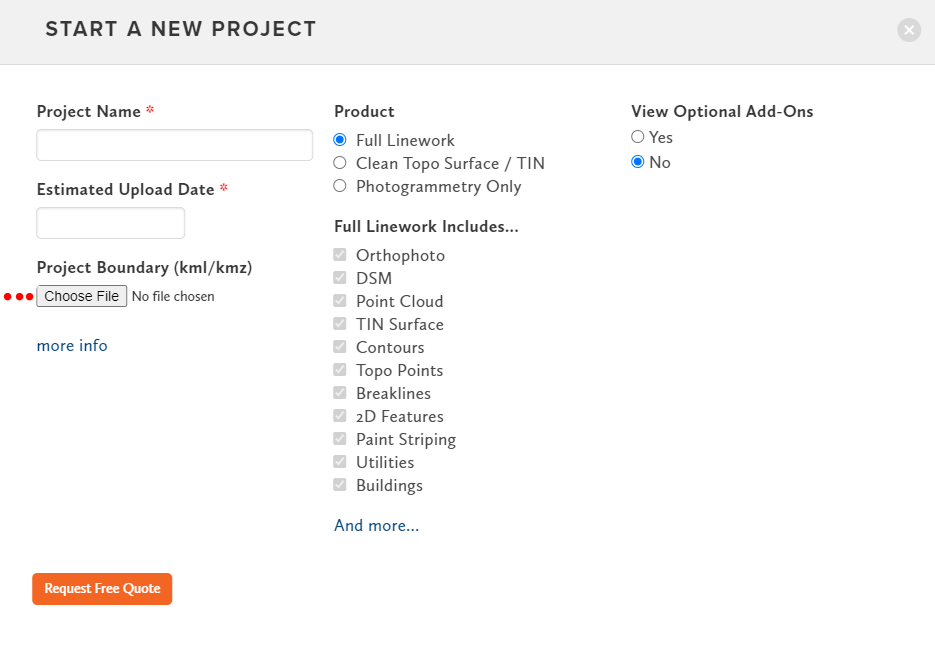
Start a New Project at aerotas.com/app
Email the KMZ to FlightOps@aerotas.com
Please provide the following info in the email:
Project scope / special considerations
Accuracy tolerances (e.g., 0.1’, 0.4’, etc.)
Feature discrepancy (if any) from Google Earth Imagery
Type of drone being used to fly the site

What you’ll get back:
Suggested GCP Layout (KMZ)
Suggested Flight Altitude
Suggested Flight Pattern
Suggested Overlap
Suggested Flight Boundaries (if necessary)
Any site-specific special considerations. E.g. Using Terrain Awareness, or flying over a heavily forested area.
Suggested GCP Layout
Aerotas Flight Ops specialists have overseen thousands of successful drone survey projects so you can rest assured that your flight plan is airtight. When you consult flight ops and follow the mission plan, your chances of having to re-fly, or revisit the site are virtually zero. Not only is this more efficient, but it also adds to the cost savings you get when you use Aerotas.
When you use Aerotas to process your drone data, you immediately get access to our Flight Ops team. The sole responsibility of Flight Ops is to guide your mission planning and data collection process. This will ensure that you are successfully planning missions, setting UAS-specific ground control, and getting the most accurate results possible from your drone-collected data.
Flight Ops Can Help With:
And more
The Aerotas Flight Operations team helps you get the most out of your drone surveying missions. Email us! FlightOps@aerotas.com
If you would like to discuss ways to improve your drone program Aerotas is here to help.
INCREASED FLEXIBILITY | SAVE TIME | BETTER DELIVERABLES
Contact us anytime at (949) 335-4323, or support@aerotas.com